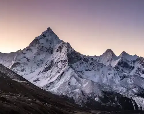
A river pushes the summit of Mount Everest up


Mount Everest, the world's highest peak, is 8,848.86 metres (29,031.7 ft) above sea level. It is a symbol of human ambition, attracting climbers and adventurers from all over the world. Located in the Himalayas, on the border between Nepal and Tibet, this towering giant is the product of tectonic forces that have shaped the landscape of the Earth over millions of years. In this article, we explore a fascinating but hypothetical scenario where a river exerts such a force on the geology surrounding it that it pushes the summit of Mount Everest upwards. While rivers play a crucial role in erosion and landscape formation, the idea of a river pushing the mountain upwards raises a thought-provoking question about the interaction of natural forces, the geography of Mount Everest, and how local river systems might contribute to its rise.
Recommend


Show key points
- Mount Everest, standing at 8,84
- 86 meters, sits on the border between Nepal and Tibet within the majestic Himalayas.
- Formed by tectonic plate collision, the Everest region is continuously rising due to ongoing geological activity.
- ADVERTISEMENT
- Glaciers in the region feed important rivers like the Dudh Kosi and Bhote Kosi, which shape the valleys through erosion.
- Despite its harsh environment, the area hosts diverse ecosystems, including rare wildlife like snow leopards and mountain flora.
- Rivers surrounding Everest mainly contribute to its erosion, wearing down its base and transporting sediments downstream.
- A hypothetical scenario suggests rivers could indirectly raise Everest's summit by depositing sediments that alter tectonic pressures.
- This concept highlights the subtle interplay between erosive river action and geological uplift in shaping mountainous landscapes.
1. The location and area of Mount Everest.
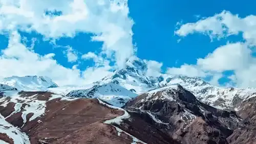
Mount Everest is located in the Mahalangur Himal mountain range, a sub-of the Himalayas. Its exact coordinates are 27.9881°N and longitude 86.9250°E. The mountain stretches on the border between Nepal to the south and the Tibet Autonomous Region (China) to the north. The surrounding area is part of the greater Everest region, also known as the Khumbu region, which is located in northeastern Nepal. This area covers an area of about 1,148 square kilometers and is home to Sagarmatha National Park, a UNESCO World Heritage Site.
The Khombo region is remote and rugged, characterized by its towering mountains, deep valleys, glaciers and high plateaus. The nearest major city is Lukla, which serves as a gateway for hikers and climbers heading to Everest Base Camp. Kathmandu, the capital of Nepal, is located about 160 kilometers southwest of Everest. The area is mainly inhabited by the Sherpa people, whose settlements and villages are scattered in valleys below the towering peaks. The strategic location of Mount Everest has made it a natural and cultural landmark, as its location in the Himalayas affects the geography, climate and ecosystems of the region.
2. Geography of Mount Everest region.
Mount Everest is located within the Himalayan mountain range, which was formed as a result of the collision of the Indian and Eurasian tectonic plates about 50 million years ago. The Himalayas continue to rise at a rate of about 1 cm per year due to this tectonic activity. The Everest region itself is characterized by dramatic landscapes, with towering peaks, deep valleys and glaciers. The mountain is surrounded by several key geographical features, including the Khumbo Valley, Sagarmatha National Park, and an intricate network of rivers and glaciers that carve the landscape. Glaciers in the Everest region, such as the Khombo Glacier, feed the rivers that serve as the lifeline of the valleys below.
3. Rivers in the Mount Everest region.
The rivers that flow near Mount Everest are primarily meltwater rivers originating from glaciers. Among the most important rivers in the region are the Dudh Kosi and Bhote Kosi, which form part of the Koshi River system. These rivers carve deep valleys across the Himalayas, draining the southern slopes of the Everest massif. It plays a crucial role in providing water to local ecosystems and supporting low-altitude agriculture. These rivers also affect the landscape through erosion, constantly forming the valleys and canyons through which they flow.
4. Nature in Mount Everest.
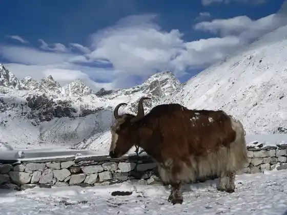
The natural environment surrounding Mount Everest is extreme and diverse. The low altitudes, below 3,000 meters, are home to temperate forests filled with rhododendrons and pines. With the ascent, vegetation gives way to mountain meadows and eventually to the barren rocky slopes of Mount Everest itself, where few plants grow due to extreme cold. Wildlife, although limited, includes the elusive snow leopard, the Himalayan tahr, and various species of birds such as the Himalayan monal. These species adapted to the harsh conditions of the region, relying on rivers and lower valleys for their sustenance.
5. The effects of rivers and their repercussions on Mount Everest.
In fact, rivers primarily contribute to mountain erosion and degradation rather than their growth. Rivers in the Mount Everest region erode the base of the mountain, carry sediment downstream and constantly reshape valleys. Over geological time, this erosion can cause significant changes in the landscape. The glaciers flowing from Everest and its adjacent peaks are essential to maintaining a dynamic balance between mountain growth and erosion. While erosion erodes the mountain at its base, tectonic activity continues to push the mountain upwards, keeping the summit of Everest high above the clouds.
6. The phenomenon of pushing the summit of Mount Everest to the top.
However, the concept of pushing the summit of Mount Everest up challenges the understanding of natural forces. In this hypothetical scenario, instead of eroding the mountain, the river exerts upward pressure on the base of the mountain. This can be visualized through processes such as sediment deposition. Over time, the river can transport large amounts of sediment, carrying them to valleys or under the mountain, creating an additional mass that exerts pressure on the earth's crust. In theory, this pressure could contribute to raising the mountain. Although rivers usually act as corrosive agents, their sediments can lead to tectonic lift by generating isolateral pressure, as the earth's crust adapts to the weight of the sediment.
7. Explanation of pushing the summit of Mount Everest to the top.
The idea of pushing the river to the top of Mount Everest to the top can be understood as a metaphor for the constant interaction between erosion and lifting forces. Although this may seem counter-intuitive, it is known that the gradual accumulation of sediment in river valleys and floodplains affects the earth's crust. If a sufficient amount of material is deposited over time, this may affect localized tectonic forces, resulting in a vertical rise in the ground. In this case, the river's contribution will not be a direct force lifting the mountain, but rather the result of long-term sedimentation that changes the balance of forces within the earth's crust. This explanation highlights the interdependence of geological processes, where rivers erode mountains and indirectly contribute to their growth.
conclusion:
While the concept of actually pushing the river to the top of Mount Everest may belong more to the realm of fantasy than geology, it draws attention to the complex and dynamic relationship between the forces that make up the planet. The rivers in the Everest region, despite their role in erosion, form an essential part of the natural system that supports life and sculpts landscapes. Although they do not directly raise the summit, rivers and tectonic forces together contribute to the continued development of the world's tallest mountain. This hypothetical scenario serves as a reminder of the delicate balance between destructive and constructive forces in shaping the natural world, where even seemingly opposing elements can contribute to massive processes.
![]()
5 practices and habits to avoid forgetting
5 practices and habits to avoid forgetting more- ADVERTISEMENT
![]()
Time Management Skills: Effective Methods to Increase Productivity
Time isn’t just ticking—it’s the most valuable thing we have. Managing it right means less stress, more focus, and better balance between work and life. With simple techniques like prioritizing tasks or using the Pomodoro method, we can work smarter, not harder, and truly make every moment count. more- ADVERTISEMENT
![]()
Human population growth: where are we now?
As the global population heads toward 10.5 billion by 2100, challenges like aging populations, food security, and environmental strain grow. While prosperity helps lower fertility, it also increases environmental harm. Addressing climate change, boosting food production sustainably, and shifting to low-carbon energy are key to balancing growth and the planet’s health. more- ADVERTISEMENT
![]()
5 color effects on how much you eat
Colors around you can sneakily influence how much you eat. White, red, orange, and yellow can trigger overeating, while blue, purple, black, and brown might help you cut back. Green invites healthy choices. So, your plate and wall color might just be helping—or hurting—your diet without you knowing it. more- ADVERTISEMENT
![]()
Can companies avoid Kodak's future fate?
Can Companies Evade the "Kodak" Destiny in The Future? more- ADVERTISEMENT
![]()
The dark side of early retirement
Early retirement sounds dreamy, but it's not all sunshine—many do it because they’re unhappy at work, feel hopeless, or want more time. But the risks are real: loneliness, regret, running out of money, and losing purpose. Think twice before jumping ship too early. more- ADVERTISEMENT
![]()
The Genius of Nature: 8 Amazing Technological Innovations Inspired by Nature
Nature has sparked incredible inventions—from quieter express trains shaped like kingfishers to painless needles modeled after mosquitoes. Even butterfly wings help improve solar cells. These smart ideas not only improve our daily lives but also open big doors in tech and business. more- ADVERTISEMENT
![]()
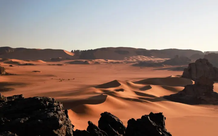
The splendor of nature and the challenge of conditions in the oasis of Taghit in western Algeria
Taghit is a hidden gem in western Algeria, where golden dunes meet ancient history. Adventure seekers can sandboard down towering dunes, explore mysterious caves, or discover 20,000-year-old rock carvings. The ancient walled city of Kassar, once forgotten, is now being restored to its former glory. more- ADVERTISEMENT
![]()
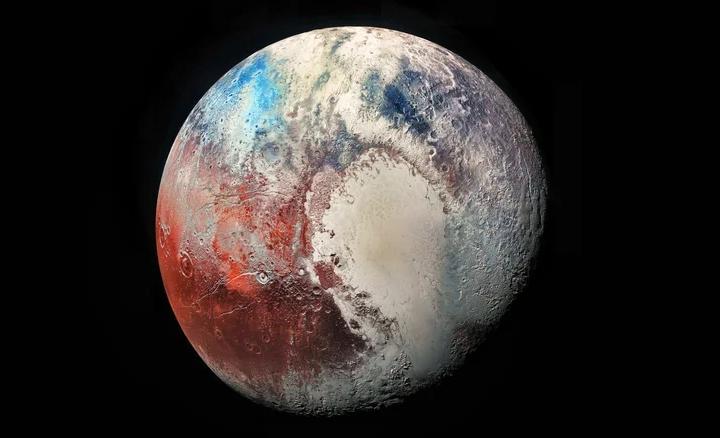
Why was Pluto kicked out of the nine planets?
Pluto, once the smallest and most distant planet, was removed from the solar system’s planet list in 2006 due to its tiny size, unusual orbit, and failure to meet new planetary criteria. Yet, Pluto remains a fascinating mystery, full of potential secrets that could reshape our understanding of the cosmos. more- ADVERTISEMENT
![]()
The Dream of Getting Rich Quick: Stories of Turning Good Fortunes into Millionaires Overnight
Overnight Millionaires: People Who Got Rich Quick more- ADVERTISEMENT